Mapping Alcatraz: Digitizing The Notorious Prison
Key Benefits at a Glance
|
Access Areas that were once off-limits for over a century were explored safely using the Elios 3, eliminating risks to personnel. |
Safety The drone kept teams away from tight spaces and hazardous areas like wastewater storage, ensuring their safety during exploration. |
|
Data Quality The Elios 3's LiDAR provided high-resolution visuals, which are now being used in a broader project to digitize the entire island. |
Reporting The data collected is helping plan the long-term management of Alcatraz, protecting it from damage caused by climate change and heavy tourism. |
Pete Kelsey, founder of VCTO Labs, is a leading figure in storytelling through drone mapping and digitalization across the United States. His work often focuses on research projects related to cultural heritage and historical analysis. He has mapped the secrets of Pearl Harbor and investigated the mysterious Skinwalker Ranch, among other locations.
For over a decade, Pete has dreamed of digitizing an entire National Park. With 63 parks across the U.S., each with unique features, his goal was ambitious. In 2023, he connected with a park archaeologist at one of the most iconic sites: Alcatraz.
Planning to Digitize a National Park with Drones
Alcatraz is a small island off the coast of San Francisco, once known as the most secure prison in the world. It operated from the 1930s until the 1960s, when it was decommissioned and later became part of the Golden Gate National Recreation Area. Since 1973, it has been open to the public under the National Park Service’s care.
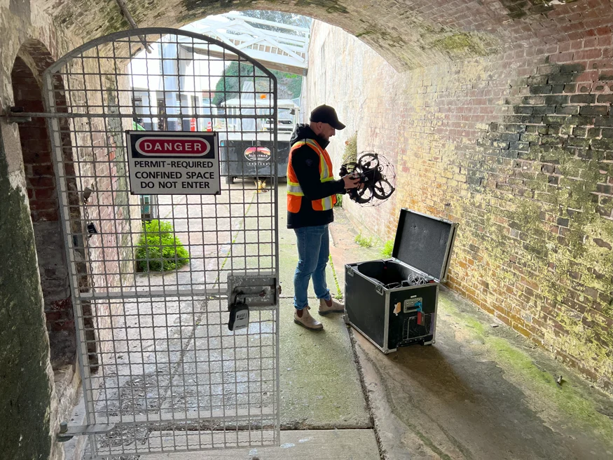 The Elios 3 can access dangerous and confined spaces, such as the dungeons of Alcatraz
Pete proposed a project to create a virtual version of Alcatraz using drones and advanced mapping technologies. The goal was to develop a scientific resource for managing the island, identifying maintenance needs, and accessing dangerous or hard-to-reach areas. This could also offer digital access to closed areas for tourists and help monitor environmental threats like rising sea levels and high visitor numbers.
It took Pete nine months to get the necessary permits, including a drone permit, since drones are generally not allowed in national parks. Once approved, he assembled a team of volunteers from various sectors, including LiDAR experts, photogrammetrists, and SLAM users.
Assembling a Specialized Drone Mapping Team
Pete reached out to his network to find specialists. Matt MacKinnon from UAS Inc. suggested bringing the Elios 3 for confined space inspections. Although Pete hadn’t used the drone before, he welcomed the addition. Everyone knew that no single tool could do it all.
Over three weeks, the team gathered data from every corner of Alcatraz, sleeping in old jail cells due to the lack of infrastructure. Experts from across the U.S. and even Australia joined the effort.
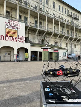
The Elios 3 at Alcatraz
Pete had never used the Elios 3 before, but Matt and pilot Geoff Helluin recommended it for its ability to navigate tight spaces. The Elios 3 could fit into areas as small as 50x50 cm and collect both LiDAR and visual data, making it ideal for the mission.
The team planned three main uses for the Elios 3: digitizing the entire island, inspecting restricted structures, and exploring hazardous areas. One of the key locations was the old powerhouse, which had been shut down for years. Inside were old boilers, chimneys, and HVAC systems—spaces too dangerous for traditional drones or ground scans.
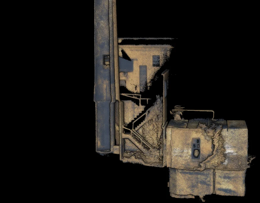
The Elios 3 captured detailed LiDAR scans of the power house stack
Another location was behind a sealed door, where a Civil War-era dungeon was hidden. The Elios 3 allowed the team to explore this area for the first time in decades, creating a 3D model of the space.
A park ranger asked the team to inspect old cisterns buried underground. The Elios 3 easily navigated these tight spaces, capturing clear images of the piping networks inside.
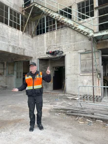
Image right: Pete Kelsey with the Elios 3 at Alcatraz
How the Elios 3 Simplified Mapping Alcatraz
All the data collected was processed using an AMD supercomputer. Pete praised the Elios 3 for its ability to access previously unreachable areas, saving time and keeping the team safe.
“I hadn’t seen the Elios 3 in action before, but I was amazed by how much it opened up. Many of these sites would have been impossible to reach without it.â€
A compilation of LiDAR data captured by the Elios 3 on Alcatraz
This project marks a significant milestone for the U.S., setting a new standard for digital preservation of national parks. It shows how modern technology can be used for education, research, and conservation. By combining multiple tools, the team achieved what was once thought impossible, proving that innovation continues to push the boundaries of what we can do.
Learn more about the Elios 3 and its real-world applications
Oxygen Supply Parts,Medical Oxygen Tank Parts,Oxygen Tank Parts,Portable Oxygen Tank Parts
CBM TECHNOLOGIES (NINGBO) CO.,LTD , https://www.sinogascylinders.com